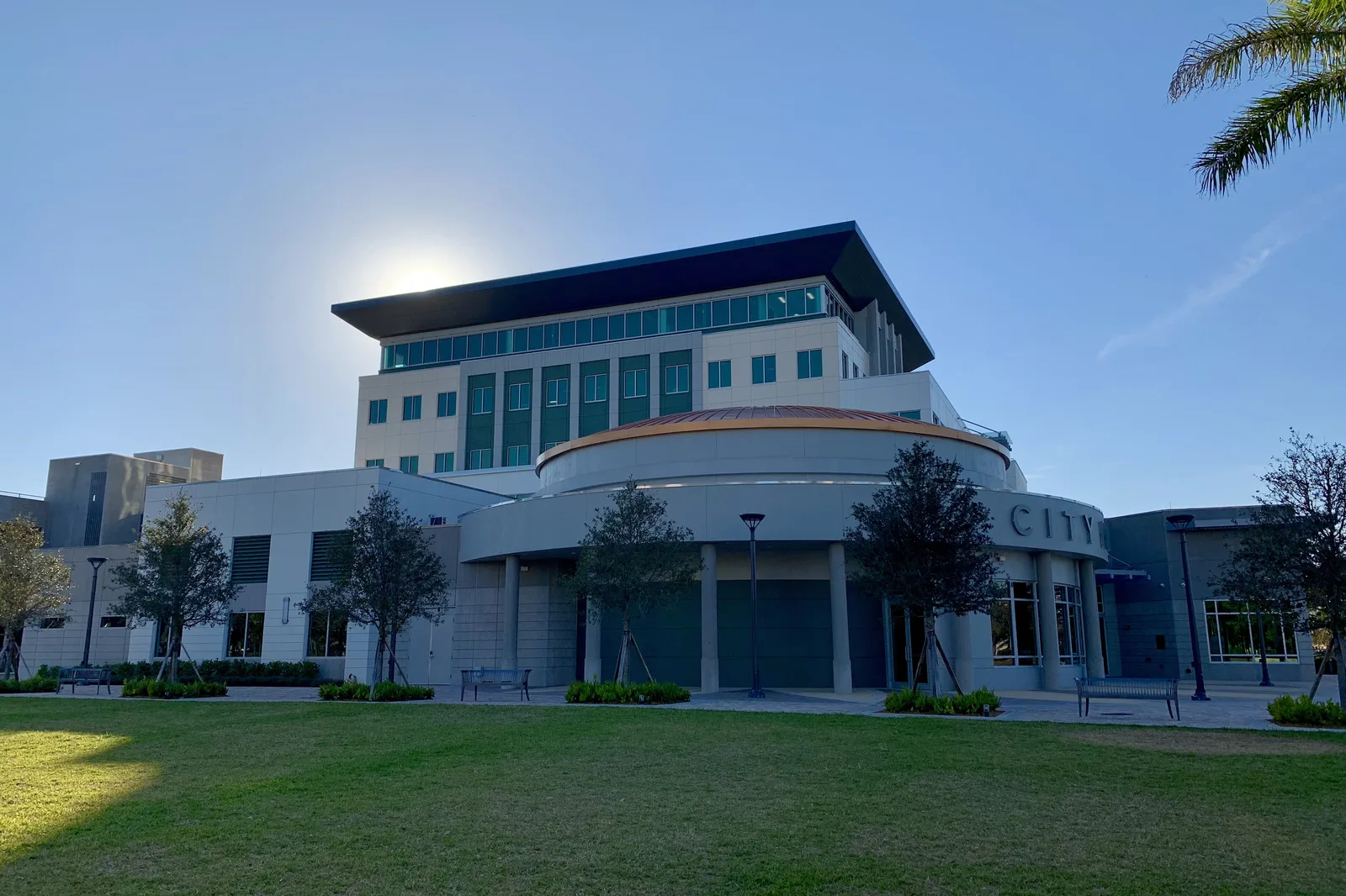
10 Coral Springs neighborhoods from Kensington to Shadow Wood: ZIP codes, zoned schools and their 2026 state grades, and August 2026 Zillow values.
Last checked Oct. 8, 2026. Sources: the Broward County Property Appraiser’s neighborhood layer, published by Broward County GIS; the City of Coral Springs’ city boundary and comprehensive plan; Broward County’s address points and 2025-26 school boundaries; the Florida Department of Education’s 2026 school grades; Zillow Research; the Census Bureau; and OpenStreetMap.
Coral Springs is a city of 136,103 people in northwest Broward County, according to the Census Bureau’s 2020-2024 American Community Survey. It covers about 24 square miles, and the city says it is now “built-out.” It was planned from scratch in the 1960s, so most of it is a grid of big roads with neighborhoods tucked between them. Sample Road and Atlantic Boulevard cross it east to west; Coral Ridge Drive, Coral Springs Drive and University Drive run north to south; and the Sawgrass Expressway (State Road 869), a toll road, wraps the west and north edges. Downtown is around Sample Road and University Drive.
Three things to know before you look at a listing:
- Four ZIP codes. Of about 25,700 street addresses inside the city in Broward County’s address data, 36% are in 33071, mostly the south; 29% in 33065, the middle; 21% in 33076, the northwest; and 13% in 33067, the northeast. Zillow files 33067 and 33076 under Parkland, which shares them.
- Four high school zones. In Broward County’s 2025-26 school boundary data, 31% of addresses in the city are zoned for Coral Glades High, 26% for Coral Springs High, 22% for J.P. Taravella High and 21% for Marjory Stoneman Douglas High, which is in Parkland. School zones do not follow city limits; always check one address with the district’s Find My School tool.
- One public school district. Every public school is run by Broward County Public Schools. Its Redefining Our Schools plan, with a final vote Dec. 15, 2026, could change Forest Glen Middle and Coral Springs Elementary; see our schools guide.
The areas at a glance
Typical home value is the Zillow Home Value Index for the area’s ZIP code in August 2026: a modeled typical value for the middle third of homes, single-family homes and condos together, not a sale price. It is a ZIP code figure, so it is the same for every area in that ZIP code. School grades are the Florida Department of Education’s 2026 grades.
| Area | ZIP | Zoned high school (2026 grade) | Typical home value (ZIP) | Guide |
|---|---|---|---|---|
| Coral Springs Country Club | 33065 | Coral Glades (A) | $331,786 | Country Club |
| Cypress Run | 33071 | Coral Glades (A) | $590,058 | Cypress Run |
| Eagle Trace | 33071 | Coral Glades (A) | $590,058 | Eagle Trace |
| Kensington | 33076 | Marjory Stoneman Douglas (A) | $883,797 | Kensington |
| Maplewood | 33071 | J.P. Taravella (A) | $590,058 | Maplewood |
| Pine Ridge | 33067 | Coral Springs (A) | $754,146 | Pine Ridge |
| Ramblewood | 33071 | J.P. Taravella (A) | $590,058 | Ramblewood |
| Shadow Wood | 33071 | J.P. Taravella (A) | $590,058 | Shadow Wood |
| Turtle Run | 33067 | Coral Springs (A) | $754,146 | Turtle Run |
| Westchester | 33065 | Coral Glades (A) | $331,786 | Westchester |
For comparison, the citywide Coral Springs figure was $523,439 in August 2026, down 1.9% from a year earlier. On the year, 33065 was down 6.1%, 33071 down 0.5%, 33067 up 0.3% and 33076 flat. More in our home prices guide.
Map of the areas
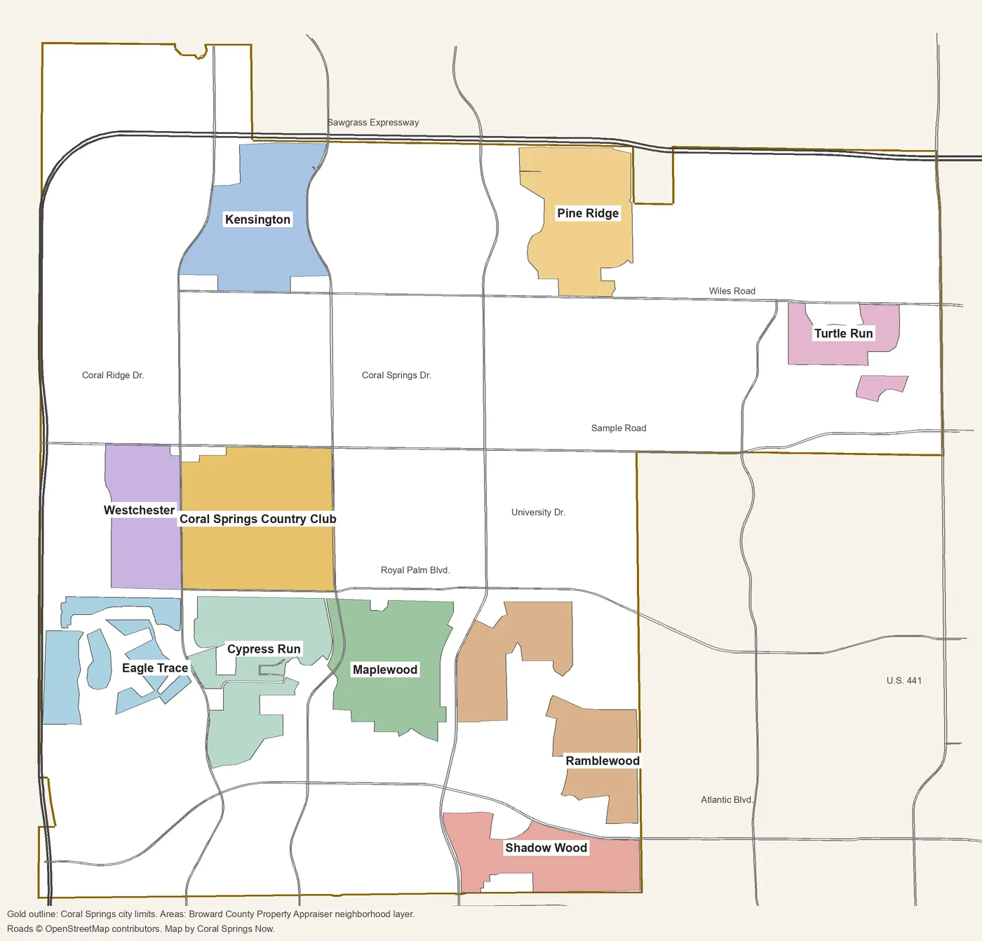
Map by Coral Springs Now. Neighborhood outlines are from the Broward County Property Appraiser’s neighborhood layer; city limits from the City of Coral Springs; roads © OpenStreetMap contributors.
The areas
Coral Springs Country Club. The largest neighborhood in the county’s layer, about 590 acres between Sample Road and Royal Palm Boulevard, Coral Ridge Drive and Coral Springs Drive. Mullins Park and the Center for the Arts are on its east side.
Cypress Run. About 400 acres south of Royal Palm Boulevard between Coral Ridge Drive and Coral Springs Drive, with Lakeview Park inside it and the most street addresses of any area in this guide.
Eagle Trace. The neighborhood around the Eagle Trace golf course, between the Sawgrass Expressway and Coral Ridge Drive, about 2.4 miles by road from exit 8.
Kensington. North of Wiles Road against the Sawgrass Expressway, less than a mile from exit 14, and the only area in this guide zoned for Marjory Stoneman Douglas High.
Maplewood. About 390 acres south of Royal Palm Boulevard and west of University Drive, around Maplewood Elementary, with Cypress Park on its western edge.
Pine Ridge. Between Wiles Road and the Sawgrass Expressway east of University Drive, about 1.5 miles from exit 15.
Ramblewood. Ramblewood, Ramblewood South and Ramblewood Villas, east of University Drive, with Ramblewood Elementary and Middle and the Coral Square mall close by.
Shadow Wood. The city’s southern edge between Atlantic Boulevard and Southgate Boulevard, with Shadow Wood Park and Three Mountains Natural Area.
Turtle Run. In the northeast near U.S. 441, governed in part by the Turtle Run Community Development District, with Tall Cypress Natural Area nearby.
Westchester. West of Coral Ridge Drive between Sample Road and Royal Palm Boulevard, a short drive from Sawgrass exit 11 and next to the Aquatic Complex and the Sportsplex.
Downtown, around City Hall and Cornerstone Plaza, has its own guide: downtown Coral Springs.
How we built this
We named only areas a public source places on a map. The sources were:
- The Broward County Property Appraiser’s neighborhood layer, published by Broward County GIS, which draws 135 named neighborhoods inside Coral Springs and records a homeowners association name for most of them. We chose 10 of the largest, spread across the city, and joined pieces that share a name (Kensington and Kensington North, for example). Each area page says which pieces it includes.
- The city’s comprehensive plan. Coral Springs’ Future Land Use Element names downtown as a Local Activity Center and the Turtle Run Community Development District as one of the bodies that runs drainage in the city; it does not divide the rest of the city into named areas.
- Broward County’s address points, about 25,700 inside the city, used for ZIP code shares, and its 2025-26 school boundary layers, updated March 24, 2026, matched to every one of those addresses on Oct. 8. The district’s 2026-27 zones may differ; the Find My School tool is the final word.
- Distances measured on the OpenStreetMap road network with the OSRM routing engine; bus routes from Broward County Transit’s bus stop data; parks from the city’s parks directory; stores from OpenStreetMap, © OpenStreetMap contributors.
We do not rank areas. Every figure on these pages is from a named public source; if you see one that is out of date, tell us on our corrections page.
Related: schools, home prices, property taxes, getting around and Coral Springs vs. Margate vs. Parkland vs. North Lauderdale.
Frequently asked questions
What are the neighborhoods in Coral Springs, Florida?
The Broward County Property Appraiser’s neighborhood layer names 135 neighborhoods inside the city. Our guide covers 10 of the largest: Coral Springs Country Club, Cypress Run, Eagle Trace, Kensington, Maplewood, Pine Ridge, Ramblewood, Shadow Wood, Turtle Run and Westchester.
What ZIP codes are in Coral Springs?
Four: 33065, 33067, 33071 and 33076. Of about 25,700 street addresses inside the city in Broward County’s address data, 36% are in 33071, 29% in 33065, 21% in 33076 and 13% in 33067.
What high school is Coral Springs zoned for?
It depends on the address. In Broward County’s 2025-26 school boundary data, 31% of addresses in the city are zoned for Coral Glades High, 26% for Coral Springs High, 22% for J.P. Taravella High and 21% for Marjory Stoneman Douglas High. All four earned an A in Florida’s 2026 school grades.
Is Coral Springs on I-95 or the Turnpike?
No. The Sawgrass Expressway (State Road 869), a toll road, runs along the city’s west and north edges, with exits 8, 11, 14, 15 and 18. I-95 and Florida’s Turnpike are to the east.
Do Coral Springs ZIP codes include other cities?
Yes. Zillow files ZIP codes 33067 and 33076 under Parkland, which shares them, so a ZIP code figure is not a Coral Springs-only figure. The Broward County Property Appraiser’s property search shows which city a parcel is in.
Have your say