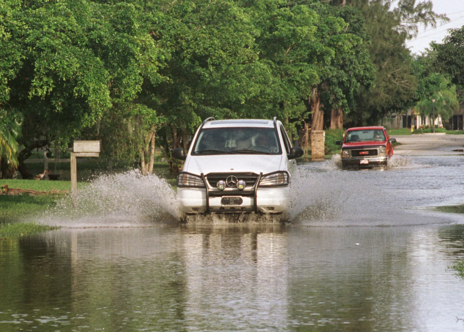
Gauges in and around Coral Springs caught 8.7 to 12.7 inches of rain in the 72 hours to Wednesday morning, the National Weather Service said. All flood alerts have ended.
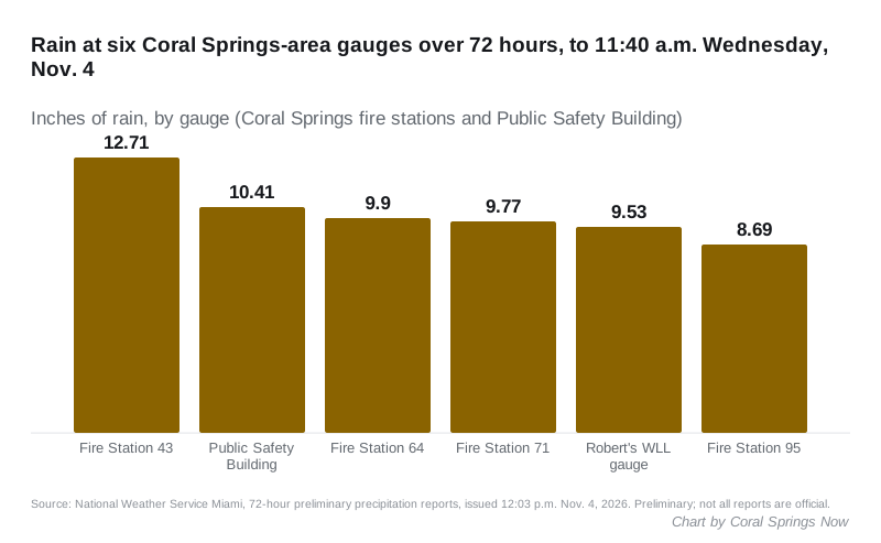
Updated Nov. 4: All flood alerts for Coral Springs have ended. Six gauges in and around the city recorded between 8.69 and 12.71 inches of rain in the 72 hours to 11:40 a.m. Wednesday, according to the National Weather Service in Miami. Two more flood advisories followed Monday night and Tuesday night. See “How much rain fell” below.
How much rain fell
The weather service in Miami published its 72-hour rainfall reports at 12:03 p.m. Wednesday. The figures run to about 11:40 a.m. Wednesday. The weather service calls them preliminary and says not all of them are official.
| Gauge (Coral Springs area) | Rain in 72 hours |
|---|---|
| Fire Station 43 | 12.71 inches |
| Public Safety Building | 10.41 inches |
| Fire Station 64 | 9.9 inches |
| Fire Station 71 | 9.77 inches |
| Robert’s WLL gauge | 9.53 inches |
| Fire Station 95 | 8.69 inches |
Nearby, a gauge 2 miles west of Parkland recorded 12.2 inches. Margate, about three miles east, recorded 8.82 inches in the 72 hours to 7 a.m. Wednesday.
Two more flood advisories named Coral Springs after the watch ended:
- 8:37 p.m. Monday to 10:30 p.m.: 1 to 2 inches had fallen, with 1 to 3 more expected.
- 7:39 p.m. Tuesday to 8:45 p.m., then 9:42 p.m. to 11:45 p.m. Tuesday: water over roadways and urban flooding, with 1 to 2 more inches expected each time.
The Coral Springs forecast for Wednesday afternoon and Thursday is mostly dry, with a 20% chance of showers and up to half an inch more rain possible.
Updated Nov. 2, 6 p.m.: The National Weather Service in Miami issued a flood advisory for northern Broward County at 5:02 p.m. Monday, in force until 7 p.m. It names Coral Springs first. The flood watch was extended from 3 p.m. to 7 p.m. Monday. See “Monday evening” below.
Coral Springs was put under a flood watch Sunday. The National Weather Service in Miami said 3 to 5 inches of rain could fall in scattered places along the east coast through Monday.
Isolated spots could get 5 to 7 inches. The weather service said that rain “may fall over a window of a few hours.”
The watch covers all of Broward County, including the Metro Broward zone that takes in Coral Springs, Margate, Parkland and Tamarac. It also covers Palm Beach and Miami-Dade counties.
Monday evening: flood advisory for Coral Springs
The weather service said radar showed heavy rain from thunderstorms over northern Broward at 5:02 p.m. Between 1 and 2 inches had already fallen. It expected 1 to 3 inches more, causing minor flooding in low-lying and poorly drained areas.
The advisory lists these places among those that will see flooding:
- Coral Springs, Parkland and Margate
- Tamarac and North Lauderdale
- Sunrise, Plantation and Lauderhill
- Ramblewood East and Sawgrass Mills Mall
A few minutes earlier, at 4:59 p.m., the weather service tracked a strong thunderstorm near Coral Springs moving north at 15 mph. It said the storm could bring wind gusts of 50 to 55 mph, strong enough to knock down tree limbs.
An advisory is a lesser alert than a warning. It means minor flooding is happening or about to.
The flood watch, reissued at 11:59 p.m. Sunday, now runs until 7 p.m. Monday. It said pockets of very heavy rain caused localized flash flooding Sunday. It expected 1 to 3 inches where storms form Monday, 3 to 5 inches in scattered places and, in isolated spots, 6 to 9 inches. That rain could fall in two to four hours.
What the weather service expected Sunday
The watch was first issued at 12:49 p.m. Sunday. The alert for Metro Broward County warns of “isolated to scattered” flash flooding. The main impact would be:
- street flooding
- road closures
- “limited impact to structures in flood prone areas”
The weather service said “uncertainty is high regarding exactly where the highest rain amounts will fall.” It said the impact “could be greater than forecast if the heaviest rainfall occurs near the coast during times of high tide.” The coast is about 10 miles east of Coral Springs.
A watch means flooding is possible. The weather service would issue a flood warning if it becomes likely or is already happening.
The Coral Springs forecast
These are the weather service’s forecast figures for Coral Springs, as updated at 3:31 p.m. Sunday:
| Period | Chance of rain | New rain possible | Wind |
|---|---|---|---|
| Sunday night | 80% | 1 to 2 inches | East around 12 mph, gusts to 24 mph |
| Monday | 70% | 0.75 to 1 inch | East around 13 mph, gusts to 23 mph |
| Monday night | 60% | 0.25 to 0.5 inch | East around 10 mph, gusts to 22 mph |
| Tuesday | 70% | Not given | East 8 to 12 mph, gusts to 21 mph |
The heaviest rain in the forecast falls between 7 p.m. Sunday and 3 a.m. Monday. Showers and thunderstorms are likely again Monday morning, before 3 p.m. The low Sunday night is around 73 degrees and Monday’s high is near 80.
That adds up to between 2 and 3.5 inches in Coral Springs through Monday night, on the forecast as published. The watch warns that some places could get more.
What the city has posted
The city’s website could not be reached Sunday evening or Wednesday, so we could not check for any notice from the city about road closures, drainage or damage. We will add the city’s own notices here if it posts any.
What it means for you
- Allow extra time Monday morning. The heaviest rain is forecast overnight, and showers are likely through the morning commute and the school run.
- Do not drive through water of unknown depth or around barricades. Low streets and parking lots can flood quickly when a few inches fall in a few hours.
- Be ready to act if flooding develops. The weather service told people in flood-prone areas to “be prepared to take action should flooding develop” and to watch for a flood warning.
- Election Day is Tuesday, and rain is still in the forecast. Broward schools are closed to students that day for an employee planning day, according to the district calendar. Our voting guide has polling place details.
For outages, see our power outages page. For storm planning, see hurricane prep in Coral Springs.
Have your say